As technology continues to grow and play a larger role in consumers’ lives, industries have transformed and adapted as well. Companies have moved away from brick and mortar to predominantly online services as a result of ubiquitous Internet access. In this shift, online companies reduce overhead costs, including rent and wages, associated with operating a physical store.
While online retailers are more convenient, purchases of goods and services are subject to additional shipping and handling charges incurred by the consumer. Even though technology has transformed a number of industries over the past 10 years, shipping and postage have remained relatively unchanged. Traditional postal service providers such as USPS, UPS (UPS), and FedEx (FDX) have remained the primary source of shipping and handling for major online retailers.
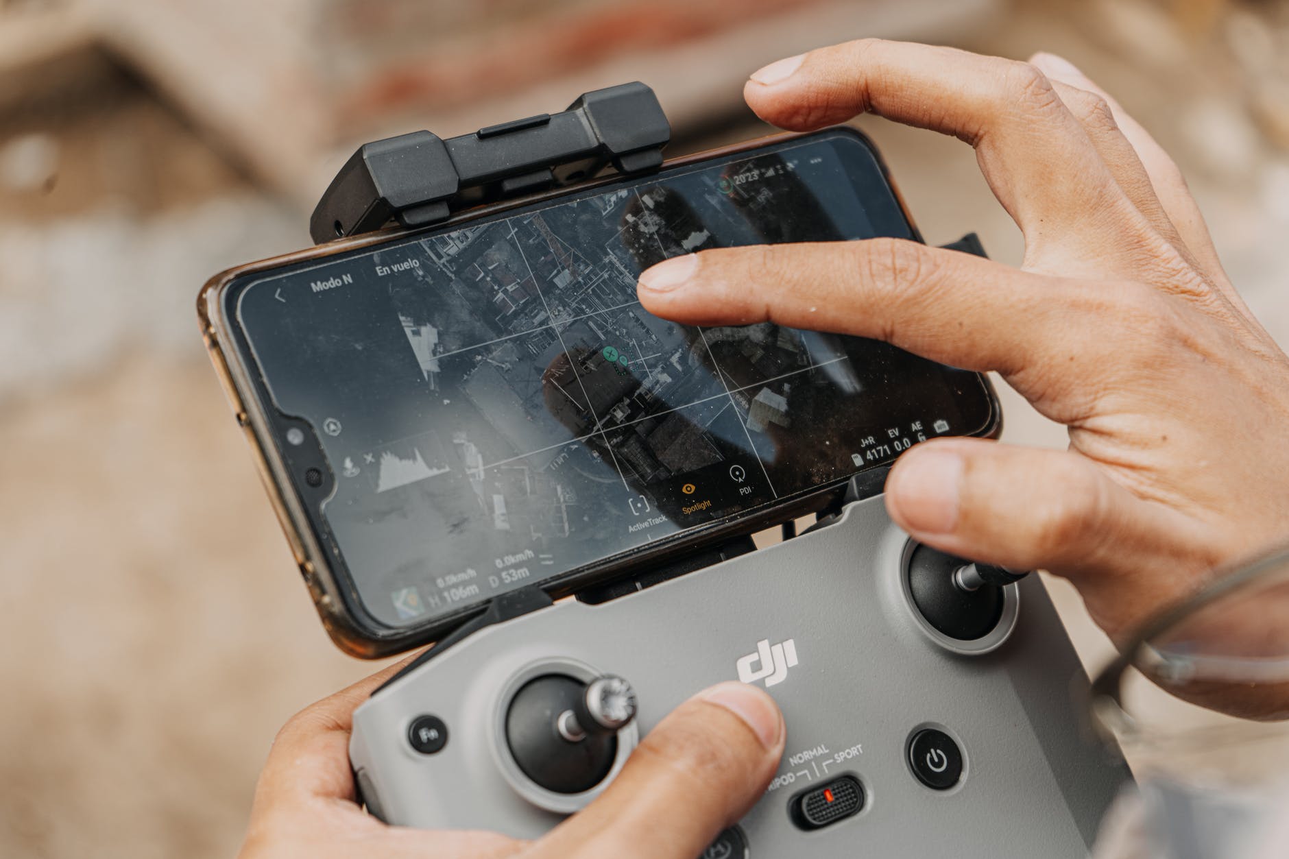
Recently, Amazon (AMZN) has challenged the status quo with Amazon Prime Air. Amazon Prime Air is a drone delivery system that anticipates package deliveries in 30 minutes or less1 . The program has not been executed as yet but is currently in development.
While the financial and economic impact of drones is robust, the Federal Aviation Administration’s (FAA) regulations in conjunction with privacy and safety concerns have delayed the launch of commercial drone services.2
Regulations
Amazon’s efforts to launch unmanned aerial delivery systems have been delayed as a result of FAA regulations. Currently, drones in the U.S. are sanctioned for military, research, and recreational use. Military drones are not subject to the same regulations as those used for research and recreation.
At the moment, unmanned aerial vehicles (UAV) in the U.S. are regulated up to a height of 400 feet of airspace in populated areas. Commercial use of drones has not been sanctioned by the FAA and is currently illegal. With concerns about air space and ground safety, the FAA is reluctant to provide licenses allowing companies to test drone services within the United States.3
Amazon’s inability to research aerial delivery within U.S. borders has led the ecommerce leader to test this new technology in the United Kingdom, with successful tests run in Cambridge, England, in 2016. In 2015, the FAA did provide Amazon with permission to test current models of drones, but by then Amazon had also been testing in Canada.
One of the main setbacks to drone use for commercial activity is the FAA’s rule requiring “line of sight.” This rule requires a drone operator to have the drone in their line of sight at all times, which defeats the purpose of using drones commercially, especially for deliveries.4
Economic Impact
Rapid technological innovation has provided consumers cutting-edge products at affordable prices. Traditionally, drones had been limited to military use due to high costs and technical sophistication. However, due to economies of scale, consumers can purchase drones for less than $100.
With widespread access, consumer companies such as Amazon have explored the use of unmanned aerial vehicles for commercial purposes. Amazon Prime Air has promised a 30-minute delivery service for packages of up to 5 lbs. Google (GOOG), in altruistic contrast to Amazon, has developed aerial drones for environmental conservation and delivery of medicine to remote locations.1
The environmental impact is also immense. Powered by batteries, drones are more environmentally friendly than delivery trucks. If delivery drones gain widespread usage, this would reduce the reliance on vehicles for many companies. This would have an adverse impact on automobile manufacturers, but the impact on the environment would be a boon and would help many countries reduce emissions, helping meet emissions targets set in various global agreements.
The economic implications of commercial drone use are undeniable. The market for drones is estimated to be $127 billion across a variety of industries. Notably, the commercial use of drones will predominantly affect agriculture and infrastructure more so than commerce. Due to the ability to cover large areas, drone use in agriculture is anticipated to effectively feed and hydrate plants while also limiting exposure to diseases.
On a macroeconomic scale, the integration of UAVs could create more than 100,000 jobs. Over a 10-year span, job creation from commercial drone use will consist primarily of manufacturing jobs and drone operators. Likewise, states will benefit from tax windfalls, stemming from increased economic activity.5
The implications clearly have a positive impact on businesses and consumers. Consumers directly benefit from job creation, resulting in additional earnings. Commercial drones will also allow industries to realize savings from cost-effective means of inventory, transportation, and distribution. These cost savings can be passed down to the consumer through a reduction in prices.
Disadvantages
While the financial implications of drone use are robust, numerous consumers, states, and regulators believe sanctioned UAV use to be detrimental. 44 states have passed their own laws on drone usage for commercial, recreational, and public use. Widespread use of drones is anticipated to increase privacy concerns among citizens nervous about corporate and government data collection. Amazon drones utilize a camera and GPS to navigate delivery destinations, which many believe to be intrusive.
Furthermore, drone delivery services offered by Amazon and other companies will face logistical roadblocks. Traditional postal services maintain the liability of damaged or stolen property incurred in the delivery process. However, without human monitoring, a drone is unable to ensure seamless deliveries. Likewise, deliveries in major cities are bound to encounter numerous issues. Accessing apartment units within city skyscrapers is an insurmountable feat for an unmanned aerial vehicle.
Aside from logistical and privacy concerns, wildlife, such as birds, face higher risks with the greater number of aerial vehicles. The FAA estimates that birds cause more than $1 billion in damages to aircraft in the United States.6
The Bottom Line
Amazon’s continued efforts to test and research unmanned aerial vehicles have put pressure on Congress and the FAA to reform drone regulations. The integration of drones into national airspace will not only benefit ecommerce businesses like Amazon but industries such as agriculture, public safety, and natural disaster management, to name a few. In a more altruistic manner, Google anticipates the use of its drones for the delivery of medical products and as a means of protecting the environment.
The economic impacts associated with UAV integration consist of job creation and billion-dollar growth. Likewise, industries cut costs from more effective means of transportation and distribution. Even with the apparent disadvantages, it is estimated that every year integration is delayed, the U.S. loses $10 billion in financial growth.
Every business needs a logo. They play a crucial role in your business by establishing a good first impression and creating a strong foundation for brand identity. Your logo not only helps people remember your brand, but it separates you from your competitors, builds trust, and honestly, it’s expected.
However, an animated logo is not something that’s expected, and that’s one of the biggest reasons why you need one.
The Benefits of an Animated Logo
Animated Logos Increase Brand Awareness
Like we said above, logos in general are an integral tool for promoting awareness of your brand. You can safely assume that if a static logo does this, an animated logo will do it even better. They’re memorable, recognizable, and versatile. It may take a few different interactions for consumers to have any brand recognition with a static logo, but you can count on an animated logo imprinting in someone’s mind almost immediately.
Animated Logos Make for Better Storytelling
Not only does an animated logo help you tell your company’s overall narrative, it becomes a flexible asset for video content., too. This narrative and the video content you produce help your audience make emotional connections to your brand, and if your brand has a strong story to tell, people are much more likely to relate to it.
Animated Logos Elevate Your Brand’s Presentation
We all know first impressions are important. Consumers want to do business with companies that appear professional and trustworthy. In more instances than not, one of the first things we consider when judging the standard of a company is how they present themselves, and in this determination, we look at the quality of their logo.
As consumers continue to transition to online video content over television, their expectations for websites and how companies present themselves change, too. When you choose to have a custom animated logo designed for your brand, you’re keeping up with current trends. When consumers see you meeting the demands of the market, you appear more professional to them.
Animated Logos Are Incredibly Versatile
You don’t need a video content library to utilize an animated logo. In fact, there are several ways to leverage an animated logo if you don’t have a backlog of videos:
Social media posts
Your website
Presentations
Online promotions
We strongly believe that if a company is serious about building a strong, memorable brand, that they have to invest in a logo. When you add animation to that logo, you’re taking things to the next level and putting yourself head and shoulders above your competitors. Here at Terrier Tenacity, we love creating animated logos that give our clients the edge they need. If you’re interested in how we can help, just reach out! We’re happy to provide our clients with no-obligation consultations.
Drones or Unmanned Aerial Vehicles (UAVs) in construction are gaining in popularity, but not everyone is aware of how impactful they can be. Drones are now able to serve a variety of purposes, ranging from data capture, film creation and security. UAVs have also proven to be a cost-effective alternative in construction industry. This article discusses 6 areas of construction that are not only benefiting from UAVs, but providing a cheaper alternative to traditional methods.
Defining a UAV or Drone
A UAV or drone is an aircraft controlled by a human operator by use of a remote control, tablet, smartphone or computer. Initially developed for use in military operations, nowadays however, its use is expanding to other applications. One of the most popular uses of drones has been capturing videos and aerial photography. In the past, professionals were needed to do these, but cheaper and more accessible devices have hit the market, which now allow consumers to capture video and images in high quality. Price points for UAVs are extremely varied and investing in one for your business will require some research, and training by the user. Once that has been settled however, UAVs are a worthy long term investment.
Land Surveying is Easier and Faster
UAVs make land surveying much quicker than easier before. Rather than having crews out in the field for days at a time, land surveying can be done in just hours. Drones have made this process much simpler, allowing you to be in the same position while controlling the UAV. Land surveying for buildings, roads and bridges can greatly benefit from greater uses of drones. With less staff working on this project, companies can allocate less resources for land surveying, ultimately saving them time and money.
Data can be Instantly Acquired
A drone will be able to give you immediate results. In aspects of construction, including land surveying, processes are typically manual, hand-written and can take days and even weeks to collect and analyze data. With drones, video information can be synched with the back office, providing businesses with data as soon as it is captured. Whether it is regular inspections, safety checks, or progress reports, UAVs can transfer data instantly which can be used by your business to act upon the results, or even keep customers in the loop more frequently.
Greater Safety Precautions can be Put in Place
Constructing skyscrapers, roads and bridges can be an incredibly dangerous endeavor. Although it is impossible to avoid every accident, drones can be used to assess the safety pitfalls that may exist throughout a construction site. If foremen or site supervisors are weary of sending crews to a particular portion of the jobsite, having a drone inspect the area beforehand can help prevent accidents.
Video and Photography will Improve Marketing
As bidding for projects becomes increasingly difficult, get a leg up on your competition by introducing more videos on your company website and social media. Video has become an extremely powerful marketing tool, but with drones now in play, has become a cost-effective alternative. Fitted cameras can be used for time lapse videos that document the progress of each project. Additionally, drones can be used to provide your prospects and customers with videos that provide real-time progress. Aerial photography was once extremely expensive and had to be done by professionals. With UAVs however, you are now provided with a cheaper, yet equally effective option.
Stay Up-to-Date with Real Time Visibility
The ability to monitor several jobsites in a short amount of time is especially beneficial for project managers. Handling multiple jobs at once can be extremely stressful, and often there isn’t enough time given to each project. With UAVs, project managers can gain a quick glance at how all their jobs are doing, in real time. Rather than physically visiting each job, project managers can gain a much easier way to keep an eye on all that is happening. Drones do not replace the need for project managers to visit each jobsite, but provides up-to-date information, which helps to increase overall visibility. Travel costs can also be avoided along with time spend in each jobsite, making UAVs an incredibly valuable asset for any construction company.
Disruptions caused by federal, state and local reactions to the pandemic upended what we knew about running a small business, forcing professionals to find ways to connect with consumers and keep their doors open.
E-commerce, which comprises buying and selling on digital platforms in business-to-business and business-to-consumer channels, became a lifeline. The benefits of buying online include convenience for the customer, increased selection and safety during the pandemic. On the other hand, potential costs to the customer include limited access to customer service, long delivery times and lost purchases.
How Did Pandemic Restrictions Affect Small Businesses?
The crushing impact of the government mandates on small- and medium-sized enterprises (SME) was sudden and devastating.
A survey of 5,800 SME conducted by the Proceedings of the National Academy of Sciences in the first months of shutdowns — before the trillions of dollars in federal bailouts became available — found that 43% closed at least temporarily because of government restrictions. The impact on SME employment, which accounts for half of all U.S. jobs, amounted to staff reductions of 30%.
Moreover, the survey found median monthly expenses of $10,000, combined with lost revenue and limited cash reserves, required SMEs to cut costs drastically (layoffs and shutdowns), take on additional debt or go out of business. Federal Reserve economists estimate that 200,000 excess SME failures (above the normal forecast for the period) occurred before states began lifting pandemic restrictions.
During all that, small businesses and independently owned franchises that cater to local clientele, especially those who need customers coming through the doors — food services, hospitality, arts and entertainment and retail — had to adjust their models to include e-commerce to survive.
How Did E-Commerce Help Businesses Manage the COVID-19 Mandates?
From global enterprises to local mom and pops, businesses had to re-think ways to leverage digital platforms and reach consumers in their homes. The film industry, for instance, began releasing motion pictures straight to subscribed streaming because theaters were closed. Likewise, specialty retailers in verticals from outdoor recreation to home workout equipment began offering free delivery and other perks through their e-commerce presence.
Groceries, convenience stores and restaurants joined the digital revolution by adopting online platforms that enabled customers to shop and pay online and pick up at the curb or request at-home delivery via gig-economy transportation.
It was a business revolution that took just three months.
McKinsey & Co. reviewed e-commerce data from 2009 through the first quarter of 2020. The curve of a graph representing the percentage of U.S. companies with digital platforms showed a moderate increase until December 2019, when it went nearly vertical, increasing from 15% to 35% by the end of Q1 2020.
“If you’re feeling whiplash, it might be the ten years forward we just jumped in 90 days’ time,” McKinsey said.
Is Ecommerce Now a Competitive Mandatory?
While e-commerce enabled small businesses to connect with consumers during the most severe pandemic mandates, the McKinsey report also noted that it allows customers to access more sellers and try new brands.
“Consumers and customers have begun to alter their buying patterns and shift to digital channels, products and services — opening up entirely new fronts in the competition for customers,” it wrote in an appendix to the report.
HE BENEFITS OF USING UNMANNED AIRCRAFT SYSTEMS (DRONES) FOR MUNICIPAL PROJECTS
The rise in popularity of drones has opened the door to a variety of new opportunities for municipalities. Here are 6 ways that drone use can add value to your construction projects and save your team time and money.
1. Efficiency. Using a drone to assist in surveying can save your team a lot of time, especially when gathering data for large areas and/or areas with tough terrain. Survey projects that normally take days or even weeks can be completed in hours with the use of a drone, leading us nicely to benefit number 2…
Drone footage of a Road (photo credit: DJI)
2. Cost effective. Because drone surveying can be completed with such efficiency, municipalities can significantly save on cost. A project that saves time is a budget-friendly project!
3. Collect large amounts of data in a short amount of time. Drones allow your project team to collect millions of points, elevations, colors, and photos. This data can dramatically improve the accuracy and quality of important project deliverables like surveys, aerial images, and construction reports.
4. Adds value to your project. The large quantity of project data provided by drone images enables the project team to make difficult decisions quickly and accurately. For example, high quality drone photos provide municipalities with survey-grade, geo-referenced photos at a higher resolution than most online map databases. These images provide incredible project value for very little cost.
Drone footage of a Quarry (photo credit: Trimble)
5. Survey unsafe or inaccessible areas. Because drones are unmanned, they allow project teams to gather data for areas that may have previously been difficult or even impossible for them to access with traditional surveying methods, like quarries, cliffs, and rugged terrain.
6. Capture data in real-time. Drones allow your project team to track site construction and improvements in real-time, making ongoing site assessment easy and efficient. For example, if there’s a major rain event, drone footage will help your project team make the best decisions on how to focus their time and give them the tools they need to take the necessary measures to deal with pooling and runoff. Again, this information can save your team time, energy, and money.
If so, you probably noticed a few things like: Blaring pop music, dimly lit rooms, the stench of overly-priced cologne and the smiling faces of American teenagers covering the walls.
Love them or loathe them, the clothing retailer succeeded in creating a level of brand recognition most of their peers never will. Abercrombie’s unique brand identity allowed them to charge premium prices and dominate the teenage apparel sector, during the late 90s and early 00s.
You may not have a storefront, but you do have a brand.
Is it strong enough?
4 Benefits of a Strong Brand Identity
Too many people overlook their brand identity and go straight to promotion. They promote, promote, promote without giving much thought to how the identify of what they are promoting impacts the final outcome.
We live in a world of “me too” marketing, where we just want to be noticed. Most brands don’t care if you compare them with the competitor, and pricing is usually the only differentiator a prospective customer can decipher.
That’s why brands need to start adopting a growth marketing mindset. Marketing is not just about attention, it’s about changing beliefs in the target audience.
It’s not about promoting your brand. It’s about promoting how your brand is different.
Ultimately, brand is about caring about your business at every level and in every detail, from the big things like mission and vision, to your people, your customers, and every interaction anyone is ever going to have with you, no matter how small. Whether you know it or not, whether you have a swanky logo or not, you do have a brand. The question is whether or not it’s the brand you really want.
A clearly defined brand identity is like a North Star: It guides you in making a variety of important decisions that create a consistent company experience for customers, employees and key stakeholders alike.
1. Strong Branding Makes You Memorable
While many consumers take the time to research and compare options, others choose whatever they happen to recognize. It is for this reason, established companies like Coca-Cola, Starbucks and KFC spend billions a year on advertising.
They are capitalizing on the concept of brand recognition.
While you might not have the budget of a Fortune 500, you can still employ the same tactics in your online marketing. And, honestly, it doesn’t even have to be a tactic — making yourself recognizable to customers is just good common sense. A solid brand identity consists of standardized font, color and logo choices that are used to represent your business in all marketing materials.
2. Brand Recognition Builds Trust
Another less obvious benefit of perfecting brand identity? A smartly designed website can make your company appear stronger and bigger than competitors. Customers tend to place greater trust in more established companies.
A strong brand identity says, “We won’t take your money, and run away to Aruba.”
As a bonus, people also expect to pay more for established products and services. Send them the link to a janky WordPress site, or a poorly designed promotional offer, and they may say to themselves: Do these people really know what they are doing?
Of course, there will always be independent thinkers who won’t judge a book by its cover. However, those types of buyers are far and few between. Going the extra mile with a professionally branded site fosters trust.
3. Strong Branding Filters Out Bad Leads
Next, curating a strong brand identity filters leads on your behalf. The reality is you don’t want to do business with everyone; you want to do business with the people who are most aligned with your core values. The reason being? Those individuals will be your best customers.
For example, say you sell a premium coffee subscription service. Your ideal customer isn’t Mike who gladly pays 79 cents a cup at 7 Eleven every morning. Your ideal customer is Susan who considers coffee an affordable luxury and has been eyeing slow drips on Amazon since last Monday.
A thoughtfully curated brand identity will simultaneously attract Susan and detract Mike, thus making it easier for you to close sales and develop long-term customer relationships.
4. Brand Identity Supports Product Launches
No matter your vertical, opportunities to introduce new products and services to the marketplace will always exist. Listening to customers, anticipating their wants and creating innovative solutions is good business. The question is always: Can we afford to introduce something new right now?
Businesses with established strong brands, and loyal customer followings, have a leg up here. It’s easier and less expensive to introduce beta products to customers who already trust you, than to convince strangers to try something different. Consistent inbound marketing coupled with strong brand identity work together to create enthusiastic followings who want to hear from you.
How to Strengthen Your Brand Identity
There are several things you can do to support a cohesive brand identity. If you’re unsure where to begin, start with these quick tips:
Take a Visual Inventory: Are you using the same logo version across all platforms? How about your fonts, color schemes, photography and other design elements? Are they consistent and are they accurately representing the prices you charge?
Analyze Messaging: Is your website’s content an accurate representation of who you are as a company? Does your messaging have a clear point of view, and is it consistent across all platforms? Are you providing material for each stage of the Buyer’s Journey.
Create a Game Plan: Are there things you can update yourself right now, to at least make it more cohesive? If bigger changes are needed, what is your budget?
Get Staff On Board: Brand is about more than appearance, it’s the experience customers have when interacting with any facet of your company. Embody your brand values as a team.
Stand Out from The Crowd
As previously discussed, the question isn’t whether or not you have a brand — the question is whether or not it’s the one you really want. A strong brand identity can both initially attract customers to you and keep them coming back for more.
Due to increasing online competition, having a distinct identity and message has never been more important. The companies who take the time to really get clear on what they stand for, and communicate it in a way that makes people care, will always have a competitive edge.
This past January, at a clay mine near Golden, Colorado, Alena Iskanderova made a startling discovery: The tracks of an ancient relative of the crocodile — once preserved for some 100 million years — had been largely erased by erosion.
In the 11 years since paleontologist Martin Lockley, an associate curator at the University of Colorado Museum of Natural History and professor emeritus at the university, first documented the tracksite, the fossilized footprints left by the animal had lost much of their depth — from roughly 7 to 12 millimeters down to 3 to 4 millimeters, Iskanderova said.
That the effects of the elements could visibly diminish the tracks in such a short time points not only to their fragility in the face of climate change and other anthropogenic threats, Iskanderova said, but the importance of photogrammetry as a means of preserving the geologic record.
WHAT IS PHOTOGRAMMETRY?
Photogrammetry is the science of reconstructing objects and environments in the physical world through photographs. The technique involves stitching together large collections of overlapping photographs to create topographical maps, meshes, and lifelike 2D and 3D digital models. Software tools help create these digital assets using pixel data from aerial photographs taken by drones or close-range photographs with handheld cameras. From surveying construction sites and flood zones to exploring fossil sites and assessing crop health, the technique has a variety of applications.
“Sometimes tracks are the only presence of animals in any paleoenvironment. So [photogrammetry] is very important for us to know what kind of animals were there,” she said. “The tracks also show us their behavior. Sometimes we can tell, for example, that there was a group of dinosaurs migrating from one point to another.”
Iskanderova is a close-range photogrammetrist with a specialization in paleontology. She uses a Canon 5D Mark II camera with a 24-mm lens to do much of her work, which has included documentation of ornithischian (“bird-hipped”) dinosaur tracks, small invertebrate burrows and the first reported Mesozoic track of a small heron-like bird called Ignotornis mcconnelli. Most of her work occurs in the South Platte formation — a sandstone-rich rock bed in the foothills of Colorado’s Front Range.
“Sometimes tracks are the only presence of animals in any paleoenvironment. So [photogrammetry] is very important for us to know what kind of animals were there.”
After snapping hundreds of overlapping pictures, Iskanderova uses Agisoft Metashape Pro 1.7 to patch them together into a single 3D image. By aligning pixels in the photos, the software renders something called a point cloud — a three-dimensional constellation of colored dots that reveal the contours of a surface. These points are then layered with a textured mesh to create lifelike visualizations, including depth maps showing the geolocated contours of a surface.
“This is why photogrammetry should be taken as a best practice for fossils and tracks studies,” Iskanderova wrote. “[Many scholarly] papers give measurements as numbers but don’t document how the measurements are made in connection to the start and end points. Each scientist, or a fieldwork assistant, will take the measurements differently. With photogrammetry, you can record not only the length, width and depth [of tracks] but also the start and end points.”
A photogrammetric rendering of one of the most complete and well-preserved Cretaceous crocodilian tracksites
Ground Control to Major Robot
Photogrammetry is nothing new. The centuries-old method of reconstructing measurements is rooted in principles of perspective and projective geometry practiced by artists, such as Leonardo da Vinci, and formalized into a science by German mathematicians Rudolf Sturm and Guido Hauck in the late 19th century. Yet the field is rapidly evolving through innovations in software and aerial photography.
Today, photogrammetry is used in commercial applications as diverse as public safety, construction, civil engineering, automotive manufacturing, agriculture and military reconnaissance. And a growing number of use cases has been a boon for the software companies that provide 3D modeling and post-production tools.
Analyses from Data Bridge Market Research predict the photogrammetry software market will see a compound annual growth rate of more than 13 percent between 2021 to 2028, with photogrammetry software expected to reach a market value of $2.56 billion by 2028.
“I think the big revolution has been with drones,” Tristan Randall, a strategic project executive at the architectural software company Autodesk, said. “In the context of a construction project, for example, where you want to monitor your site conditions, you can purchase drones that cost a couple thousand dollars. So capturing the photogrammetric data has become much, much easier.”
Photogrammetry does not require highly sophisticated cameras, Randall told me. It can be performed using digital single-lens reflex (DSLR) cameras, video reels, satellite photos or even images captured with an iPhone — virtually any digital camera that can store multiple images.
“I think the big revolution has been with drones … capturing the photogrammetric data has become much, much easier.”
But the low-cost availability of drones has opened a once largely terrestrial application to a range of new airborne possibilities — from creating large-scale maps to assess crop health or plan for emergency relief operations to producing lifelike 3D models of buildings, roadways and flood zones.
A photogrammetrist can buy a serviceable drone for as little as $800, said Christopher Kabat, the owner and founder of the drone consultancy ProAerial Media. Once programmed, the drone can capture hundreds of photos of a large-scale real-world environment, like a subdivision or city district, in hours.
Prior to the flight, the pilot selects the flight path and the number of photos the camera will take, based on their desired output resolution. Outfitted, typically, with a 1- to 2-inch diameter camera on a rotating gimbal, the drone passes back and forth over the landscape taking pictures — hundreds of them — for later processing.
“It’s literally taking every image and taking all the pixels in each image and looking for another image with at least three matching pixels,” Kabat said. “And it’s going to do that for every single photo that you have.”
Depending on the goals of a project, teams can use drone-based photogrammetry to create photorealistic orthomosaic maps corrected for the curvature of the Earth, capture valuable volumetric data — like the amount of soil a building team needs to extract to dig a foundation — or generate interior models for virtual home tours on real estate sites like Zillow. Aerial photogrammetry, though, tends to work best for large-scale projects, not fine architectural details, which are often represented with laser scanning.
The Google Earth project to map cities in 3D actually used both technologies, Randall told me, capturing large regions with photogrammetry and applying signature building features with manually scanned data.
“The key thing to remember is that [a point cloud] is a very, very accurate representation of the physical features of a site,” Randall said. “We call it ‘mowing the lawn,’ because you’re basically moving the camera in lines that overlap. And then you use those photos in, say, an engine like Autodesk ReCap, to stitch them together.”
A 3D textured-mesh of a four-acre office park rendered in Pix4Dmapper from roughly 275 drone photographs.
Photogrammetry Has Dozens of Use Cases. But Construction Is Where Most of the Excitement Lies.
Over the past decade, aerial photogrammetry has radically transformed the construction industry. Instead of hiring a survey team to spend weeks photographing a site with GPS-synced tripods, developers can send a drone — like DJI’s Phantom 4 RTK or Autel’s Evo 2 RTK — into the air to capture site conditions in hours, often at a much lower cost, said Ryan Sweeney, a sales manager at the Denver office of the photogrammetry company Pix4D.
Drones are good at capturing high-resolution photographs, in part because they fly so low — a maximum of 400 feet above the ground (or higher, if within range of a structure), compared to at least 500 feet above the ground for a human-piloted plane, as stipulated by Federal Aviation Administration regulations. Drones can also capture a site from multiple vantages and reach places that might otherwise be dangerous for humans to be — like hazardous chemical sites.
At a typical construction site, about 500 images captured by a drone in a 30-minute flight can be processed on a personal desktop computer in roughly two hours, Sweeney said. Flight height, camera quality and the level of photo overlap all affect the quality of the point cloud and final outputs. A 75 percent horizontal and vertical overlap is a good target for a quality data set.
“Implementing photogrammetry gives you the ability to almost have your eyes on location. You can monitor the progress [of a construction site] visually, very simply.”
In addition to knitting the photos together, software modeling tools like Recap, Pix4D, or all-in-one aerial photogrammetry platforms like 3DR and DroneDeploy, align geotagged pixels against cartesian coordinates ground sampled locally or imported from networked GPS data. The reconstructed image files are, thus, correlated one-to-one with their real-world locations — what some refer to as digital twins. These outputs can be represented as 3D building models, topographical maps, depth maps, contour line drawings and 2D orthomosaics.
Because these renderings are accurate to within inches, architects and engineers can use them to update working “as-built” models so they reflect on-the-ground conditions.
If a construction crew moves a planned sidewalk four inches to the west to avoid a root system, the design team doesn’t need to manually update their renderings, Kabat said. They can import updated point cloud data to virtual environments to correct such discrepancies on the fly.
Meanwhile, construction managers can use the 3D models to keep tabs on large-scale development projects, while working remotely.
“Implementing photogrammetry gives you the ability to almost have your eyes on location,” Kabat said. “You can monitor the progress [of a construction site] visually, very simply.”
A drone flight path map created in Pix4Dmapper. |
Laser Scanning vs. Photogrammetry
Laser scanners can produce high-resolution 3D models and maps, often at a higher resolution than what can be achieved using photogrammetry. Yet they tend to be expensive — sometimes tens of thousands of dollars, Randall told me — and they must be moved into position by human operators to “see” their targets.
“You can imagine a construction site 20 miles from the city,” Randall said. “A pilot has to fly all the way from the airport and then go back. Even inside a building, you have to move the scanning instrument all over the site to capture different viewpoints.”
But drone photogrammetry has its limitations too. Most U.S. airports, Kabat said, are surrounded by LAANC (low altitude authorization and notification capability) grids that require formal FAA airspace authorization. A flight can be ground sampled at a given height — say, 137 feet — but fall within a restricted zone that limits the flight ceiling to 100 feet. If not coordinated in advance, that can throw a wrench in a mapping project.
The FAA’s Part 107 guidelines already require all small commercial drone operators to pass a knowledge test and be registered, but a new rule that went into effect in April requires most drones flying in U.S. airspace to be equipped with remote ID. According to the agency’s website, this “helps the FAA, law enforcement and other federal agencies find the control station when a drone appears to be flying in an unsafe manner or where it is not allowed to fly.”
“If you were flying in North Carolina, Illinois, Wisconsin — anywhere there’s much denser vegetation, photogrammetry will never be able to interpret the ground data because it can’t penetrate past the canopy roof of the trees.”
Randall told me it likely implies they have the ability to disable drones that pose a potential threat.
Drones — more specifically, their cameras — also have trouble seeing through foliage. Kabat’s company operates in the desert landscape of southern Nevada and areas of Arizona and Utah, where photogrammetry works well.
“But if you were flying in North Carolina, Illinois, Wisconsin — anywhere there’s much denser vegetation, photogrammetry will never be able to interpret the ground data because it can’t penetrate past the canopy roof of the trees,” he said.
Building edges can also be problematic. Unlike laser scanners, which measure distances as a function of the time it takes light beams to reflect off a target and return to their source, photogrammetry uses pixel matching to approximate distance.
“So depending on what’s in those pixels, you may run into challenges. If you’re shooting from directly above a building, you’re not going to be able to represent that vertical edge with as much accuracy,” Kabat said.
Documenting and Preserving Fragile Environments
But the technology is quickly getting more advanced and adaptable. Newly developed aircrafts scheduled to arrive on the market soon, such as the DJI Mavic Pro 3, are expected to have swappable payloads, Kabat told me, meaning they will let users exchange a standard camera for a zooming camera, thermal imaging camera or LiDAR (light detection and ranging) camera.
The promise of modular camera options is exciting to practitioners like Kabat, but the market for newer technologies will likely take some time to ramp up.
“Most people still don’t even know what photogrammetry is,” Kabat said. “That’s the biggest challenge: just making people aware that you can use photogrammetry to solve problems.”
“It’s not something new,” Iskanderova added. “But in certain fields, like, for example, paleontology, it’s a relatively new and growing field. And, right now, I see many, many students studying photogrammetry and doing projects. Many old-school professors are also interested in photogrammetry.”
“Most people still don’t even know what photogrammetry is. That’s the biggest challenge: just making people aware that you can use photogrammetry to solve problems.”
And it remains an active field for hobbyists. During his off-hours, Kabat traces the history of remote stretches of the American southwest with drones and handheld cameras, capturing artifacts in ghost towns and abandoned mines near Las Vegas, and Native American petroglyphs he finds along the Old Spanish National Historic Trail running from Santa Fe, New Mexico, to Los Angeles.
Recently, he engaged the nonprofit Friends of Pando about the prospect of mapping the Pando, a clonal colony of a single aspen in south-central Utah that looks like a cluster of individual trees, but is connected by a genetically identical root system that spans 106 acres. The threatened tree, among the oldest in the world, has been deemed the heaviest living organism.
“If you were to Google, ‘largest tree,’ it’s still going to be General Sherman, the sequoia tree in California,” Kabat said. “But as far as the largest organism, it’s the Pando. What they’re ultimately looking to do is provide visitors to their website the ability to walk through the aspen forest, virtually, as it changes seasons.”
Though the scale of the project is different, it’s not so far removed from what Iskanderova is doing at a more granular level with dinosaur tracks — reconstructing the fragile outlines of an environment with photogrammetry to document its existence and, hopefully, preserve it for posterity.
“With tracks or any fossils, it’s pretty much detective work,” she said. “You just go in and slowly find more details, making a story behind the remains.”
Enhance The User Experience with Powerful Custom Website Design
Custom website design is rapidly becoming a must for both local and online businesses. This is especially true if they want to stay competitive in their industry or niche. With over 1.9 billion websites online in 2018, every new website needs something unique and special to stand out from the crowd.
Custom website design creates a unique customer experience that templates and cookie-cutter options cannot match. With online business, a website is frequently a potential customer’s first impression. If it is not a positive one, they move on to the millions of other options they have to choose from.
What Is The Power Of Unique Web Design?
From a business standpoint, custom design and development means creating a unique selling position in an industry or niche. The focus is laser-precise and every site visitor knows what they are getting with you. An emotional component also exists. Designers know how to add curiosity, comfort, and trust.
Templates Vs. Custom Website Design And Development
The web is full of free and low-cost templates that make a website look neat and organized. When it comes to rising above the competition, those traits do not begin to scratch the surface of what a skilled web design company can do.
Custom design and development professionals create for the individual company’s needs and goals. This includes both the public face of the company and the usability of the administrative backend. The first requires precision, user-friendliness, and features necessary to convert the visitor into a customer or client. The latter makes it much easier for staff to update and maintain the site.
The Custom Web Design Company Matters
Business owners need the type of boost to a business that unique web design and development can bring. By creating a user experience that focuses on intuitive comfort, brandable style, and trust, the chance of standing out and succeeding increases.